
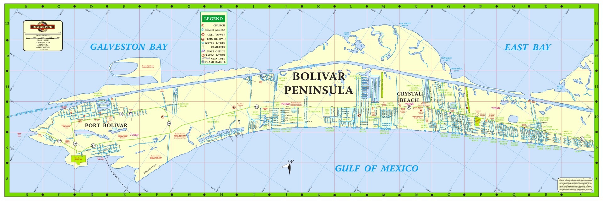
The Bolivar Peninsula, named for Simón Bolívar (1783-1830), the South American hero, is a “barrier island” stretching twenty-seven miles along the Texas Gulf Coast in a northeasterly direction to form eastern Galveston County.
At its widest point between Crystal Beach and Caplen, the peninsula is three miles wide. At its narrowest point—where Rollover Pass divides the community of Gilchrist—the peninsula is a quarter of a mile wide.
Search property for sale in Bolivar Penninsula
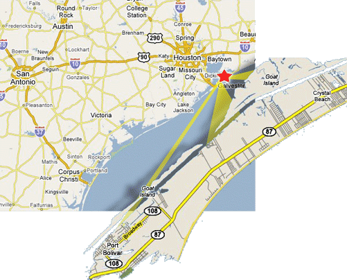
Water separates the peninsula from Galveston Island by less than three miles. The sheltered Gulf Intracoastal Waterway, which extends the length of the peninsula on the north side, is used primarily for transporting freight; at Bolivar Roads, it forms a water passageway that serves as the marine entrance from the Gulf of Mexico to Galveston Bay.
- See Census city profile for Bolivar Peninsula Texas
- See Travel Map Bolivar Peninsula
The Bolivar portion of the waterway belongs to the Galveston District and is maintained by the United States Army Corps of Engineers. Bolivar Peninsula is accessible by land from the Texas mainland only through southern Chambers County.
Towns on the peninsula, in addition to Crystal Beach (the only incorporated community), Caplen, and Gilchrist, include Port Bolivar and High Island; independent school districts serving the peninsula include Galveston and High Island.
Towns on the Bolivar Peninsula
Bolivar Peninsula History
Bolivar Peninsula, named for Simón Bolívar (1783-1830), the South American hero, is a narrow strip of land or “barrier island” stretching twenty-seven miles along the Texas Gulf Coast in a northeasterly direction to form eastern Galveston County. At its widest point between Crystal Beach and Caplen, the peninsula is three miles wide. At its narrowest point, Rollover Pass, the peninsula is a quarter of a mile wide. Water separates the peninsula from Galveston Island by less than three miles. The sheltered Gulf Intracoastal Waterway, which extends the length of the peninsula on the north side, is used primarily for transporting freight; at Bolivar Roads, it forms a water passageway that serves as the marine entrance from the Gulf of Mexico to Galveston Bay. The Bolivar portion of the waterway belongs to the Galveston District and is maintained by the United States Army Corps of Engineers.
Bolivar Peninsula is accessible by land from the Texas mainland only through southern Chambers County. Toll-free ferries are operated by the Texas transportation system every 20 minutes between Galveston and Port Bolivar. Towns on the peninsula, in addition to Crystal Beach (the only incorporated community), are Caplen, Gilchrist, Port Bolivar and High Island; independent school districts serving the peninsula include Galveston and High Island. At the southwestern tip of the peninsula at Point Bolivar is old Fort Travis, named for Alamo hero Col. William B. Travis. Jean LaffiteAccording to legend, Jean Laffite’s entire pirate crew from Galveston Island sometimes held parties on the peninsula. At least one former pirate, Laffite’s cabin boy, Charles Cronea, made his home there at Highland, where he is buried.