

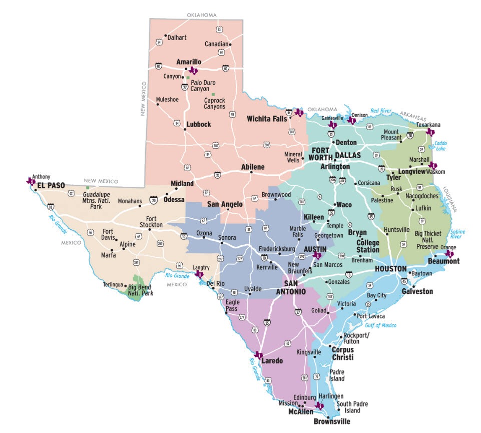
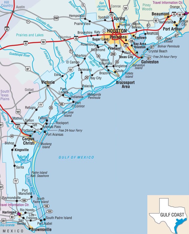
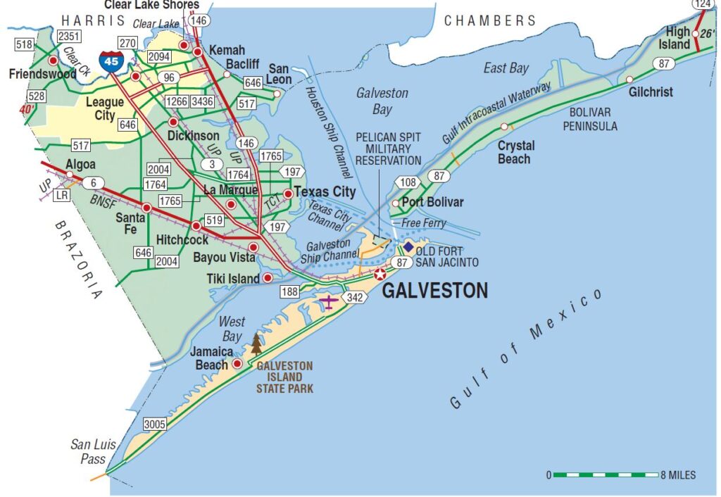
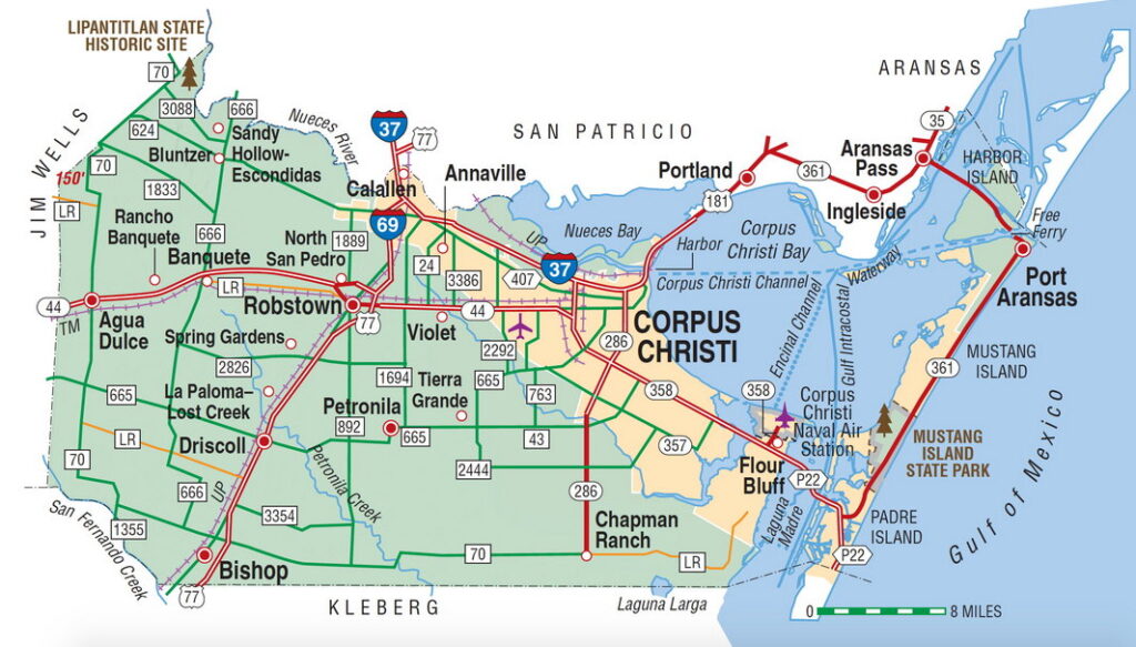
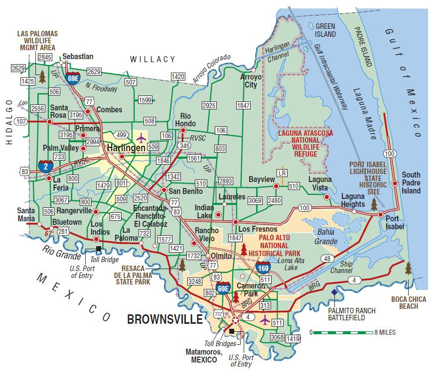
Maps of the Texas Gulf Coast


USGS National Map
The National Map is a suite of products and services that provide access to base geospatial information to describe the ...
Texas Coast Zoning Maps
Texas Coast Municipal Zoning Maps A zoning map shows the allowed uses of real property in certain areas. For example, ...
Texas Coast County CAD Maps
Texas Coast Central Appraisal Districts (CAD) Each Texas county is served by an appraisal district that determines the value of ...
How Texas Beach Homes uses Longitude and Latitude
How Texas Beach Homes uses Longitude and Latitude We use cloud computing to geocode each property to determine its longitude and ...
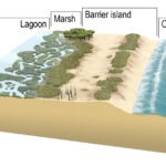
USGS What is a barrier island?
USGS What is a barrier island? The United States Geological Survey (USGS), formerly simply known as the Geological Survey, is ...
Related Pages