
All posts by Alice

Mike’s experience in the technology industry is quite extensive. During his career, he has had the good fortune of serving both as a designer of complex enterprise applications and as a corporate executive. After a career in Austin-San Antonio as an award-winning software developer for over twenty-five years, mike lives in Port Aransas managing Texas Beach Homes with a license to practice real estate in the state of Texas and a digital marketing e-Pro specialization from the National Association of Realtors. Formerly the founder/CEO of AssetWorks and USAF Officer for the New Technology Division Electronic Security Command with a graduate degree in computer science from Ohio State University.

Texas Coast Open Beaches

Texas Coastal Property Rights

In Texas, public access to Gulf Coast beaches is not just the law, it is a constitutional right.

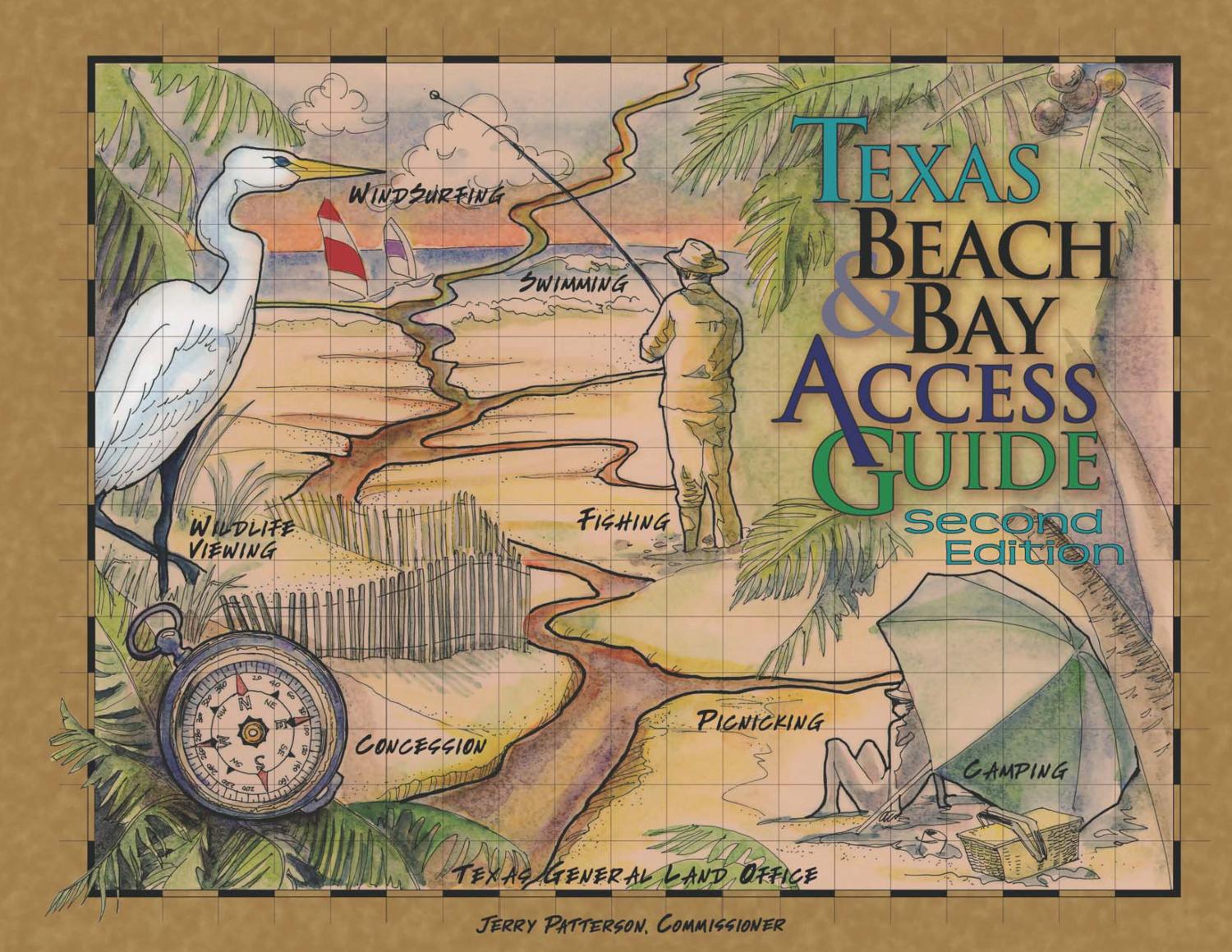
Walking along the beach in Texas has been a privilege since Texas was a Republic, and the Texas Land Commissioner protects this public right for all Texans by enforcing the Texas Open Beaches Act.

Under the Texas Open Beaches Act the public has the free and unrestricted right to access Texas beaches, which are located on what is commonly referred to as the “wet beach,” from the water to the line of mean high tide.

The dry sandy area that extends from the “wet beach” to the natural line of vegetation is usually privately owned but may be subject to the public beach easement. The line of vegetation may shift due to wind, and wave and tidal actions caused by storms and hurricanes.

Most of the beaches on the Texas coast allow cars on the beach! Only South Padre’s beach is completely off limits for cars, but the public has many access points and parking.


Background 

The Texas Legislature passed H.B. 3459, which the governor signed into law June 14, 2013. The new law amends the Texas Open Beaches Act, which means it will influence public beach access.

The Texas Open Beaches Act (“TXOBA”), passed in 1959, protects public access to the 367 miles of Texas coastline along the Gulf of Mexico. The act is a unique codification of rights held by the public in Texas since time immemorial: the right to access and use the area of the beach located between the mean low tide mark and the line of vegetation.

Expressing these rights, the law states that the public:

“…shall have the free and unrestricted right of ingress and egress to and from the state-owned beaches bordering on the seaward shore of the Gulf of Mexico, or if the public has acquired a right of use or easement to or over an area by prescription, dedication, or has retained a right by virtue of continuous right in the public, the public shall have the free and unrestricted right of ingress and egress to the larger area extending from the line of mean low tide to the line of vegetation bordering on the Gulf of Mexico.”

Where is the Boundary?

Mean high tide is determined by finding the mean of all the daily high tides over a period of 18.6 years, which is the length of the periodic astronomical cycle that affects the tides.

Can a Landowner Exclude the Public?

According to these rules, a landowner owns the beachfront to the line of mean high tide or mean higher high tide, depending on whether the original grant was a common law grant or a civil law grant. The state, then, owns the submerged land and the wet beach. The dry beach, from the applicable high-water line to the line of vegetation, is owned by the upland landowner.

What about the public’s right to access the beach? The Texas Legislature enacted the Open Beaches Act as a means of enforcing the rights of the public (where and if they existed) to access and use Texas Gulf beaches, even where they were privately owned.

  • The act, as amended, declares that Texas’ public policy is that the public, individually and collectively, shall have the free and unrestricted right of ingress and egress to and from the state-owned beaches bordering on the seaward shore of the Gulf of Mexico.
  • It also declares that if the public has acquired a right of use or easement to or over an area by prescription or dedication or has retained a right by virtue of continuous right in the public, the public shall have the free and unrestricted right of ingress and egress to the entire beach, including the privately owned dry beach.

Addendum for Coastal Property

Section 61.025 of the Texas Natural Resources Code requires a statutory disclosure to be provided to purchasers of land located seaward of the Gulf Intracoastal Waterway. The disclosure notifies the buyer of certain risks involved in purchasing real property near a beach.

Texas has its share of oceanfront property with its undeniable allure. “From the front porch you can see the sea.” The nature of its boundaries, however, and the potential rights of the public, offer specific risks and questions of law that should be considered.

Article by Rusty Adams (Nov 7, 2022), Texas Real Estate Research Center at Texas A&M University

Comments Off on Texas Coast Open Beaches

Jodi Peters, Cinnamon Shore

Jodi Peters is a broker at Cinnamon Shore, a Texas beach home sponsor.

She is passionate about leading sales and marketing at Cinnamon Shore and connecting families with coastal property. Despite the challenges of 2020, Jodi helped drive an 85% increase in total sales volume over 2019, and introduced a new development, Cinnamon Shore South.

She has over 13 years of experience in the real estate industry and is dedicated to bringing more top-tier design and building professionals to Cinnamon Shore to maintain its edge in the luxury coastal real estate market in Texas.

Visit Cinnamon Shore

Comments Off on Jodi Peters, Cinnamon Shore

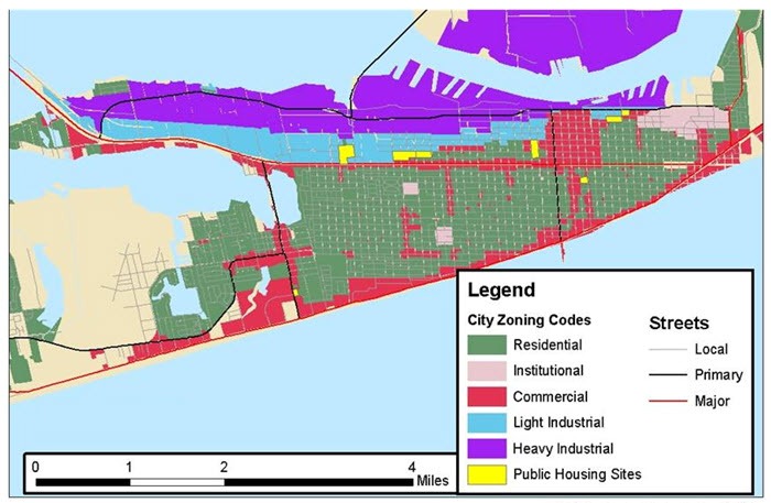
What Are Zoning Laws?

What Are Zoning Laws?

‘Zoning laws are critical’: Are you allowed to build an extension — or list your home as a short-term rental? 

  • Zoning refers to a set of regulations that restrict how property can and cannot be used. It can also mean regulating the size, shape, and scale of the buildings on a certain property within a specific geographic area.
  • Zoning laws can protect and enhance the value of real estate and prevent the incompatibility of different land uses. Most importantly, zoning laws can help accomplish the overall goals of a given community and stimulate economic growth.
  • A property can be zoned both commercial and residential. Zones are typically categorized into single-use or mixed-use properties.
  • You may also be able to find a list of zoning ordinances and zoning maps on your local government’s website.

How Do Zoning Laws Work?

Zoning laws are made by branches of local government, municipal corporation, or a county. When an area is deemed a zoning district, there will be specific regulations on how a property owner can use the land within a zone.

For example, there may be a zone designated for a particular residential style, such as single-family homes. In another zoning district, there may be a commercial designation for businesses. Of course, there can be some zoning districts determined to be mixed-use – both commercial and residential.

It’s possible that visions for a certain community will change over time, or for property owners to request an exception for a certain project. For example, if a property owner would like to start a home-based business, they can request an exception that would allow that business to run within a residential zone.

To do so, property owners can apply for a variance that may warrant an exception from some municipalities. In most communities, those impacted by the proposed amendments can voice their concerns or approval at a public hearing. However, each municipality has its own process. If you’re interested in proposing an amendment, you should reach out to your local government for the next steps.

It’s important to recognize that zoning laws are different from the rules made by homeowner’s associations (HOAs). Although the rules of an HOA can affect your property usage, the rules are not made by a local government.

What Is the Purpose of Zoning?

There are several different purposes for zoning depending on the type of property. In the past, zoning has been viewed to protect the integrity of the community. Many communities view zoning laws to ensure that residents don’t have to deal with loud noise levels or high traffic areas.

Zones can protect important natural and historical resources and ensure that facilities that risk the health and safety of a community’s occupants aren’t established near a residential neighborhood. Zoning laws can also require that buildings have an adequate level of natural lighting, air quality and even privacy.

Commercial zoning might serve different purposes. Commercial zoning laws might restrict the type of business operating within that area. For established businesses, these laws might regulate the number of parking spots available, usage of signs and access to exits and fire escapes. Each law is intended to maintain the integrity of the community and regulate growth.

Types of Zoning Restrictions

Residential

The residential dwelling units that people call home can look dramatically different throughout a municipality. With that, a local government will create several zones that encompass distinct types of dwellings. Here are a few types of housing units that can fall into a residential zone.

  • Single-family residences
  • Suburban homesteads
  • Apartments
  • Trailer parks
  • Condos
  • Home-based businesses

The zoning ordinance will determine common items that create a cohesive area such as

  • The number of, if any, animals allowed at the residence
  • Encumbrances such as the number of structures allowed on the property
  • The allowance of placements of manufactured homes
  • Whether or not a multi-family home can be built on the property

Commercial zoning laws affect businesses and include:

  • Office buildings
  • Shopping centers
  • Hotels
  • Nightclubs
  • Restaurants
  • Vacant land with the potential for business development

Industrial zones encompass businesses that work in an industrial capacity such as warehouses, manufacturing, airports, and storage facilities.

Historic – older municipalities with significant historical sections use this zoning strategy to provide protection for these buildings.  Buildings with historical significance within this zone could be subject to tax deductions.


If you need zoning information or mitigation on the Texas coast, we’re the guys that can help! 

Rather than visiting outdated and difficult city websites, or waiting in line at city offices to find zoning maps and updates, we can get you permitted land uses, lot sizes, building heights, rental restrictions, municipal codes, international building codes, elevations, construction standards, environmental, windstorm, etc. 

We have experience with residential homes, businesses, hotels, communities, high-rises, marinas, and even water parks on the Texas coast!


Comments Off on What Are Zoning Laws?

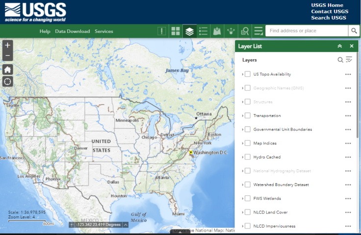
USGS National Map

The National Map is a suite of products and services that provide access to base geospatial information to describe the landscape of the United States and its territories. The National Map embodies eleven primary products and services and numerous applications and ancillary services.


Launch the USGS National Map Tool


Maps using ESRI Living Atlas technology are more versatile than Google maps and without Ads! See just what you want. Most Government and GIS professionals use ESRI, for example, The U.S. Census Bureau’s American Community Survey (ACS) layers are viewable in the Living Atlas and include over one hundred layers covering a wide range of topics on housing, income, internet, education, disability, health insurance, and more.

Need a specific map built using the ESRI technology tools Just Ask!
Custom maps have never been easier using ESRI technology

  • High-Resolution Imagery Map
    • Build your own maps adding layers from an impressive collection of government datasets like climate, demographics, elevation, zoning, etc.
    • Control the appearance by selecting the base map like Color pencil, Open stencil, Mid Century, National Geographic, or Antique

Examples:


The geographic information available from The National Map includes boundaries, elevation, geographic names, hydrography, land cover, orthoimage, structures, and transportation.

    • Included in The National Map are the latest elevation data from the 3D Elevation Program (3DEP), surface water data from the National Hydrography Datasets (NHD), and place name data from the Geographic Names Information System (GNIS). In addition, The National Map provides continuously updated, seamless datasets for recreational trails, roads, boundaries, structures, land cover, and imagery.
    • The National Map also serves as the data source for modern USGS topographic maps such as US Topos and OnDemand Topos. US Topo maps and scans of historic USGS topographic maps are also available as a part of The National Map.

Data and products from The National Map are used by government, industry, academia, as well as the public, in support of geologic mapping, natural hazard planning, natural resource conservation, emergency management, recreation, and many, many other applications.

The National Map is managed by the USGS’ National Geospatial Program in coordination with federal, state, and local partners and may be accessed through data download, web map services, and an online viewer.


See More National Coast Tools


Comments Off on USGS National Map

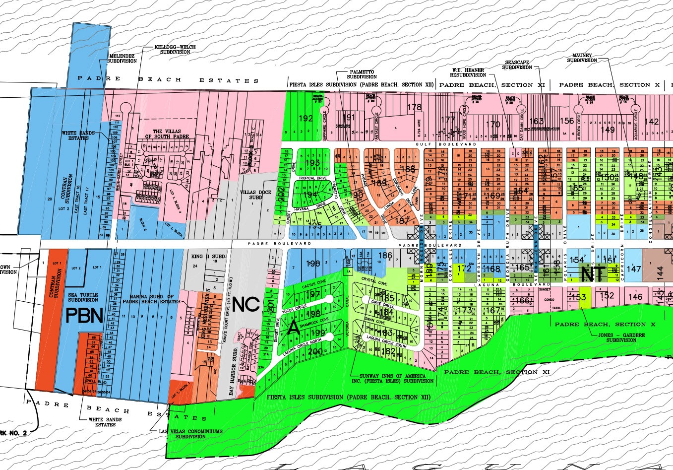
Texas Coast Zoning Maps

Texas Coast Municipal Zoning Maps

A zoning map shows the allowed uses of real property in certain areas. For example, commercial use or residential use. Zoning maps assist developers, businesspersons, and residents in finding out what they can build in certain areas, and restrictions on property use, for example if short term rentals are allowed.

Zoning Map Documents (PDF)

Zoning GIS (Online)

More information at https://texasbeachhomes.com/topics/building-construction/

Comments Off on Texas Coast Zoning Maps

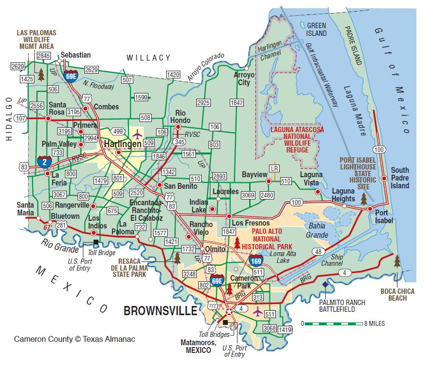
Texas Coast County CAD Maps

Texas Coast Central Appraisal Districts (CAD)

Each Texas county is served by an appraisal district that determines the value of the county’s real property by individual parcels of land. Land parcels are boundaries that have associated information such as property owner, land use, and value. This information is recorded and maintained in the appraisal districts.

Cameron County (South Padre / Port Isabel)

Nueces County (North Padre / Port Aransas)

Galveston County (Galveston / Bolivar Peninsula)

More information at https://texasbeachhomes.com/topics/building-construction/

Comments Off on Texas Coast County CAD Maps

Travel Texas Guides

Texas Coast Travel Guides

The over 350 miles of Texas Gulf Coast is protected by barrier islands stretching from Galveston to South Padre Island. With your toes in the sand and surfing on the horizon, you’ll fall in love with the Texas Gulf Coast.


TravelTex Explore Texas Gulf Coast and Beaches 

Read about Riptides


The Texas coast is a resting place for over six hundred migrating bird species, more than any other state, and visitors can wander along the Great Texas Coastal Birding Trail, which offers 308 individual birding sites, enhanced by boardwalks, observation platforms and special landscaping designed to attract native and migrating birds.

Texas Parks and Wildlife


GET A FREE TEXAS TRAVEL GUIDE
Discover places to see, things to do and more. The Travel Texas Guide is prepared by the Texas Department of Transportation.

If you are planning to cross into Mexico during your stay in Texas, consider a stop at a Texas Travel Information Center or a Texas border city’s chamber of commerce or convention and visitors bureau for useful tips. Information for crossing into Mexico can be obtained from a Mexican consulate or by going to visitmexico.com. For information regarding the process to enter or reenter the United States, visit cbp.gov/travel.


STATEWIDE LINKS

Comments Off on Travel Texas Guides

SPI Realtors

www.spirealtors.com

The South Padre Island Board of REALTORS® is a non-profit organization that serves South Padre Island, Port Isabel, Laguna Heights, Laguna Vista and Bayview. Our members are more than just licensees, they are REALTORS® who abide by a strict Code of Ethics and have the local expertise to help you buy or sell real estate. REALTORS® have access to members only forms, information and technology that gives them a competitive edge in the marketplace and enables our members to provide superior services to buyers and sellers of real property in Texas.

Comments Off on SPI Realtors

Badri Sathyanarayanan, CTO

Badri Sathyanarayanan, Chief Technology Officer, Texas Beach Homes

As the Chief Technology Officer for Texas Beach Homes, Badri is responsible for guiding the company’s technology strategy and ensuring that it aligns with the overall goals and objectives of the organization.

His diverse background in technology and transformation, program management, consulting, and business development suggests he has the skills and expertise to lead the development and implementation of technology solutions that will drive business benefits and deliver measurable results for Texas Beach Homes.

Additionally, his experience working in different countries and industries such as retail, utilities, education publishing, healthcare, real estate, maquilas, banking reference data, asset management, and materials management indicate he brings a wealth of knowledge and diverse perspective to the role.

Comments Off on Badri Sathyanarayanan, CTO

Jennifer Watts, Agent

Jennifer Watts is a licensed real estate agent in the state of Texas.

Jennifer was born and raised in Colorado Springs, Colorado. She is the proud mother of three amazing daughters and is blessed with two grandchildren. Her professional career initially began as a nurse and later a lab/X-ray technician before becoming an entrepreneur with her then-husband. Together, they created and ran several businesses. Several of their investments were in buying/selling real estate.

Jennifer has lived part-time in Port Isabel/South Padre Island since 2003 and has always felt it was her home. In 2018 she purchased a condominium on the island and decided to make it her permanent residence. Driven by her passion to help people, she embarked on a career with Origins Behavioral Health here on the island. There she successfully worked with and counseled people with addictions and behavioral disorders. Her passion did not stop there as she continued her education to become a Nationwide Certified Trauma Recovery Coach and created a program to reach out to those struggling with past traumas.

She has always maintained her passion in working in real estate and in October of 2021 made the decision to pursue a career in Real Estate.

In February of 2022 Jennifer obtained her Real Estate License and teamed up with Alice Donahue South Padre Island Real Estate, feeling with the vast knowledge and experience Alice Donahue has she would be nothing less than successful.

Jennifer’s drive, ambitions, motivation, and passion for working with people make her an asset to Alice Donahue in South Padre Island.

Comments Off on Jennifer Watts, Agent